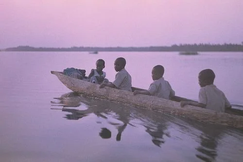
OpenStreetMap emerges as a crucial tool in addressing the humanitarian crisis in Sudan, where traditional aid efforts overlook peripheral communities and critical infrastructure remains unmapped. Hernández highlights how this participatory mapping platform can help bridge visibility gaps, allowing local actors to contribute vital geographic data. The article envisions four possible futures shaped by the intensity of conflict and access to open mapping tools: (1) High conflict with minimal access leads to continued invisibility of rural communities; (2) Low conflict with limited access risks long-term neglect of peripheral areas; (3) High conflict with ample access could enhance response coordination despite violence; and (4) Low conflict with broad mapping use enables inclusive recovery.
One month after the Future of Aid 2040 report launch in New Delhi, hosted by IARAN, START Network, CHL, and the Humanitarian Hub, discussions continue across Berlin and Bogotá. The report envisions a reimagined aid system by 2040 centered on inclusivity, local leadership, and collective action. Key voices—including Sneha Mishra, Anuj Tiwari, Rajesh Kapoor, Vasundhara Pandey, and Manu Gupta—called for equitable resource distribution, decentralized decision-making, and stronger community ownership. AIDMI emphasized integrating local knowledge and the evolving role of AI to enhance future aid delivery and resilience.

“The baby is in our hands — and I am terrified.
The fight to gain power was one challenge. The responsibility that follows is far greater. Leadership has shifted to local CSOs, but no resources came with it. No plan for capacity strengthening. No donor message saying, ‘This is the system you must support.’ If we create babies malnourished from the start, we risk watching them die before they grow — and the true victims will be the communities we serve.”
— Puji Pujiono, Senior Adviser, Pujiono Centre

Amid systemic disruption and the unraveling of traditional aid paradigms, a transformative form of leadership is emerging from the Global South. Rooted in Indigenous knowledge, communal values, and contextual intelligence, this leadership model challenges entrenched power asymmetries and redefines humanitarian effectiveness. It does not seek to replicate Northern models, but instead cultivates authentic, regionally grounded responses shaped by collective wisdom and mutual accountability. This new leadership embraces complexity, fosters North-South symbiosis, and prepares for an increasingly multipolar humanitarian landscape. In doing so, it offers not only adaptation—but the foundation for a more just, inclusive, and sustainable future for humanitarian action.

OpenStreetMap emerges as a crucial tool in addressing the humanitarian crisis in Sudan, where traditional aid efforts overlook peripheral communities and critical infrastructure remains unmapped. Hernández highlights how this participatory mapping platform can help bridge visibility gaps, allowing local actors to contribute vital geographic data. The article envisions four possible futures shaped by the intensity of conflict and access to open mapping tools: (1) High conflict with minimal access leads to continued invisibility of rural communities; (2) Low conflict with limited access risks long-term neglect of peripheral areas; (3) High conflict with ample access could enhance response coordination despite violence; and (4) Low conflict with broad mapping use enables inclusive recovery.

In light of recent geopolitical shifts, the humanitarian sector is experiencing significant changes. The « To Each Their Playing Field » scenario from The Future of Aid: INGOs in 2030 report anticipates a fragmented humanitarian landscape, with decentralized responses and diverse actors beyond traditional INGOs. To remain relevant, INGOs must accelerate localization efforts, empowering regional partners and redefining their value propositions. This transformation is crucial to effectively navigate the complexities of a multipolar world and continue delivering impactful humanitarian assistance.

